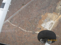

These two photos were taken by Richard Winslow. The first is near hat Rock Road, and displays part of the swath. The second is south of lake O'Donnell. The large cleared area is used by the fire department as a practice area and by PPS as a wood waste dump. If you click on each photo, you will see the details more clearly.
No comments:
Post a Comment